Slashdot Mirror
Domain: lightpollution.it
Stories and comments across the archive that link to lightpollution.it.
Comments · 12
-
Why The Stripes
The striped nature of the cloud features is probably because the data was gathered by the DMSP Weather Satellites using their low light detection sensors. These do not take a full-earth view of the world as the sun-synchronous GOES satellites do. DMSP vehicles operate in a lower orbit but a high angle and circular orbit. This brings them near the poles, and they cross the equator at roughly 9AM or 3PM locally to take advantage of the sun angle and shadows on clouds. They scan a wide path beneath them in visible and infrared channels, and have been used for years to do night light intensity mapping, such as for light pollution surveys.
The stripes are the paths from the several vehicles in orbit assembled over time when they passed near the poles.
Your tax dollars at work! -
It's not just about the lights
Pollution in general turns the atmosphere into a hazy soup that scatters, reflects, and blocks the light of the stars. The lights in our urban and suburban night-time environments only make that haze visible because of the light reflected from it, making it harder to see dim objects in the sky. There is a scale to measure the 'darkness' of a viewing location, called the 'Bortle Dark-Sky Scale', which allows you to evaluate the 'darkness' your viewing location. Using this scale, the night-time sky in Galileo's time would achieve a ranking of '1', the darkest sky possible. If that were the case, it would have been possible to read a book or a newspaper with ease by the light of the full Moon.
The 'World Atlas of the Artificial Night Sky Brightness' has some nice pix of worldwide light pollution.
An article in 'The New Yorker' magazine from August, 2007, discusses light pollution and John Bortle. -
Ok... Why?
Im going to look at something completely different: used land mass..
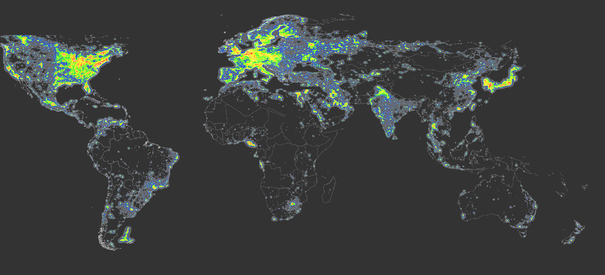
Light Map of the world.
Why this? This shows where population is via light pollution. If we pay attention to Oceania, we see that very little land mass of Australia is used, in opposition to places like the eastern US, most of Europe, and Japan.
Why would a little-used large landmass country like Australia use this, and not the densely packed countries? -
Re:Competition, competition, competition
That's all find and dandy, except the 10% that do live more than 200 Km from the US border have broadband.
This 90% thing is both true and totally misleading. Ontario has 40% of the population of Canada, and roughly 101% of them live within 200 Km of the US border. A very large proportion of Quebec lives within 200 Km of the US border, and they have another 25% of the population.
But, go west, and the only significant population near the US border are the cities of Winnipeg and Vancouver. Calgary and Edmonton, roughly a million each, are far from the US border. And get this: somehow, somebody figured out how to get broadband to them, and every other rural resident in the province of Alberta, sell it for less than the average American ISP wants, and they make money doing it.
Saskatchewan has 1 million people, is roughly the area of Texas, and 40% of them live in rural areas. 90% live more than 200 km from the US border, 99% are more or less evenly distributed over about 80,000 square miles. They all have broadband.
Of those that are within 200 km, none are in a community of 10,000 or more. They all have broadband.
Every community in that province of 10,000 or more has broadband. Rural users who live typically a mile from their nearest neighbor (in farm country, it's illegal to own less than 1/4 section, or 160 acres. That's 1 mile by 1/4 mile or alternately, it could be 1/2 mile square. The average farm is more than 8 sections, making your closest neighbor at least 4 miles away. The largest operators farm more than 20 sections. They have broadband.
You can look at http://www.lightpollution.it/worldatlas/pages/fig2 .htmamapofthenightsky, and if you knew where I lived, you would see
You would also see the 11 million people of Ontario and the 8 million people of Quebec in the yellow/red/white area. Just like the entire Eastern United States. You know, where the population density is so low they can't get broadband.
Every urban resident in Saskatchewan (its that basically black/gray spot north of Montana) has a choice of at least two, and if you include wireless (microwave) broadband, three providers. Every rural resident has a choice of at least two, and if they are covered by WiMax, three wireless or satellite providers. Maybe it's just me, but If I were interested in expanding the reach of broadband in the US, I would explore some local level competition, as it seems like most people on Slashdot who post on this and other topics complain they have a choice of one provider.
In the meantime, I'm willing to admit that population density probably plays a role in broadband penetration. I know it was the most popular excuse the last time I posted on this on Slashdot. In 2001.
Perhaps this population density thing will work itself out by the time I post on this subject again. In 2011. -
Don't squander the view!
One thing I'm always grateful for is a clear sky on a dark night and the humbling power of the billions and billions of stars that are visible to my eye. A few months ago, there was an article on light pollution, along with links to nighttime shots of earth to illustrate the intensity of light pollution. Along with that article was the revelation that there are a growing number of people who have never seen a starry night. Sounds trivial to you, but such a simple thing is very important because it forces the alert human to put things into perspective and to see that there are greater things than man can create.
Light pollution isn't the only threat to our ability to witness astronomically significant events: space billboards will probably debut as soon as the economy goes back into upswing. Laugh if you must, but don't be surprised if future articles warn you "you'll have to squint to see Jupiter tonight, because the Coca-Cola® billboard will be about 3 to the east..." or similar.
-
Let me address something here...
-
Re:Wierd places-- Falkland islands
-
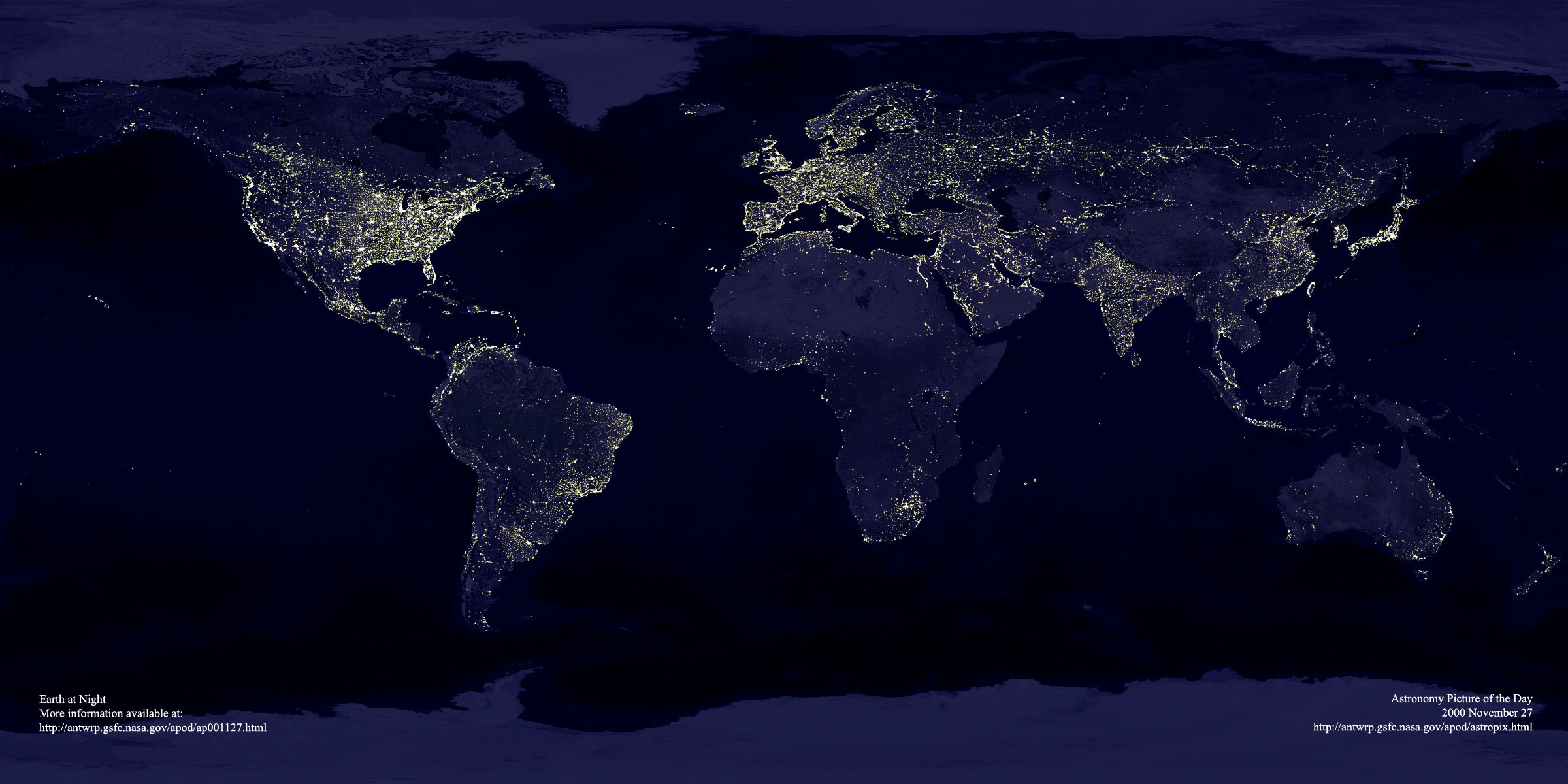
missing areasAnyone know why there's a swath missing between Israel and Lebanon from the Mediterranean eastward? See how stranglely the Africa and middle east maps both ignore it. Compare the DMSP map.
As mentioned before, the milky way is absolutely amazing when you leave the metros, especially here in the Southern hemisphere. Sad to think how few people get the chance to just stare at it in awe.
-
missing areasAnyone know why there's a swath missing between Israel and Lebanon from the Mediterranean eastward? See how stranglely the Africa and middle east maps both ignore it. Compare the DMSP map.
As mentioned before, the milky way is absolutely amazing when you leave the metros, especially here in the Southern hemisphere. Sad to think how few people get the chance to just stare at it in awe.
-
missing areasAnyone know why there's a swath missing between Israel and Lebanon from the Mediterranean eastward? See how stranglely the Africa and middle east maps both ignore it. Compare the DMSP map.
As mentioned before, the milky way is absolutely amazing when you leave the metros, especially here in the Southern hemisphere. Sad to think how few people get the chance to just stare at it in awe.
-
Re:Wierd places
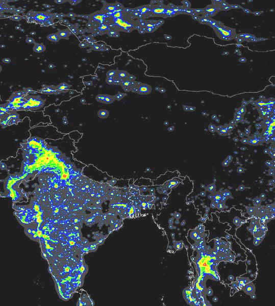
Also, look near south west Kashmir, it reckons the area is as light as much of Europe.
Actually, if I see the 'center asia' map and consult an atlas, I see that it isn't Kashmir that blazing with light -- in fact Kashmir is very dark indeed. It's the very industrialized New Delhi-Punjab-Islamabad area that's 'ablaze' with light in the figure -- and that area is filled with populous cities.And yes, the asociation of light with industries and large metropolitan agglomerations is very strong indeed.
-
Re:Wierd places
What's all that down near the Falkland islands?
That's not the only problem. Look at the Korea Strait, between Japan and South Korea. As far as I know there are no oil rigs there to make that sort of light.
Also note that the London-like lights near Nigeria are actually in the Gulf of Guinea.
There are lights in the North Sea, though I can write those off to drilling.
Anyway, quite an interesting idea. Some cities are easy to pick out, as is (for example) the Lower Nile and the associated delta.
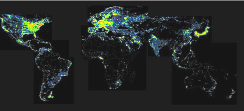
In response to another poster, the entire world is not included in this atlas. If you look closely at the big world thumbnail, you can discern the areas of the world that they've actually surveyed. Apparently they gave low priority to oceans, Siberia, and Canada.